Mglis Satsoli
Mglis Satsoli is a peak in Southwestern Georgia, Georgia and has an elevation of 2,614 metres. Mglis Satsoli is situated nearby to the hamlets Meria Keli and მერია ყელი.Notable Places in the Area
Sakornia
Peak
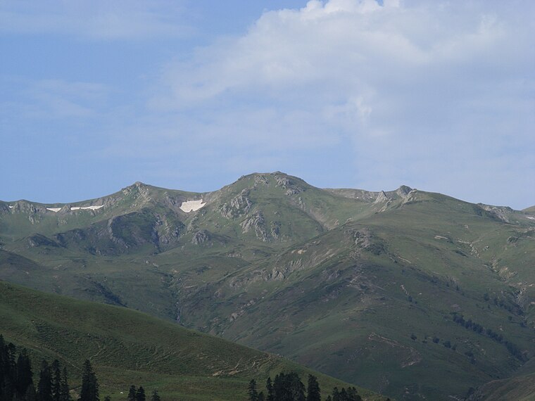
Photo: გრიგოლ, CC BY-SA 3.0.
Sakornia, is a mountain in Georgia. Part of the Meskheti Range, it is located within the Chokhatauri Municipality of Guria and has an elevation of 2752 metres.
Mglis Satsoli
- Type: Peak with an elevation of 2,614 metres
- Category: landform
- Location: Southwestern Georgia, Georgia, Caucasus, Asia
- View on OpenStreetMap
Latitude
41.7958° or 41° 47' 45" northLongitude
42.2546° or 42° 15' 17" eastElevation
2,614 metres (8,576 feet)Open Location Code
8HH4Q7W3+8VOpenStreetMap ID
node 3704172038OpenStreetMap Feature
natural=peakMglis Satsoli Satellite Map
© OpenStreetMap, Mapbox and Maxar
Also Known As
- Georgian: მგლის საწოლი
- Russian: Мглис Сацоли
Localities in the Area
- Meria KeliHamlet
- მერია ყელიHamlet
- TkisvelaHamlet
- Gori KuliVillage
- NaghvareviVillage
Landmarks in the Area
- TaginauriPeak
- Lerti LakeLake
- NaordvaliPeak
- Mt. Didi-VakePeak
- KikiboScenic viewpoint
Popular Destinations in Southwestern Georgia
Discover Batumi, Ozurgeti, Lanchkhuti and Chokhatauri.
Escape to a Random Place
Discover other peaks in the world.
About Mapcarta. Thanks to Mapbox for providing amazing maps. Data © OpenStreetMap contributors and available under the Open Database License. Text is available under the CC BY-SA 4.0 license, excluding photos, directions and the map. Photo: Andrzej Wójtowicz, CC BY-SA 2.0.